
Part 2: Use Cases
Civil Engineering & Linear Infrastructure in Practice
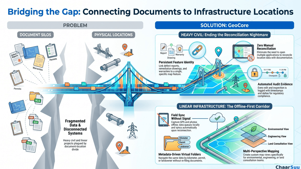
This is the second article in our series. It builds directly on the problems described in Article 1, showing how they play out on real civil and linear infrastructure projects.
Roads, bridges, transit, pipelines, transmission lines, and rail are the projects where the problems from Article 1 cause the most trouble. They are big, run for years, heavily regulated, and are all about location. Almost every record points to a spot along a route or a corridor, and there are huge numbers of those records. When your documents and your maps sit in separate systems, this is exactly where things fall apart.
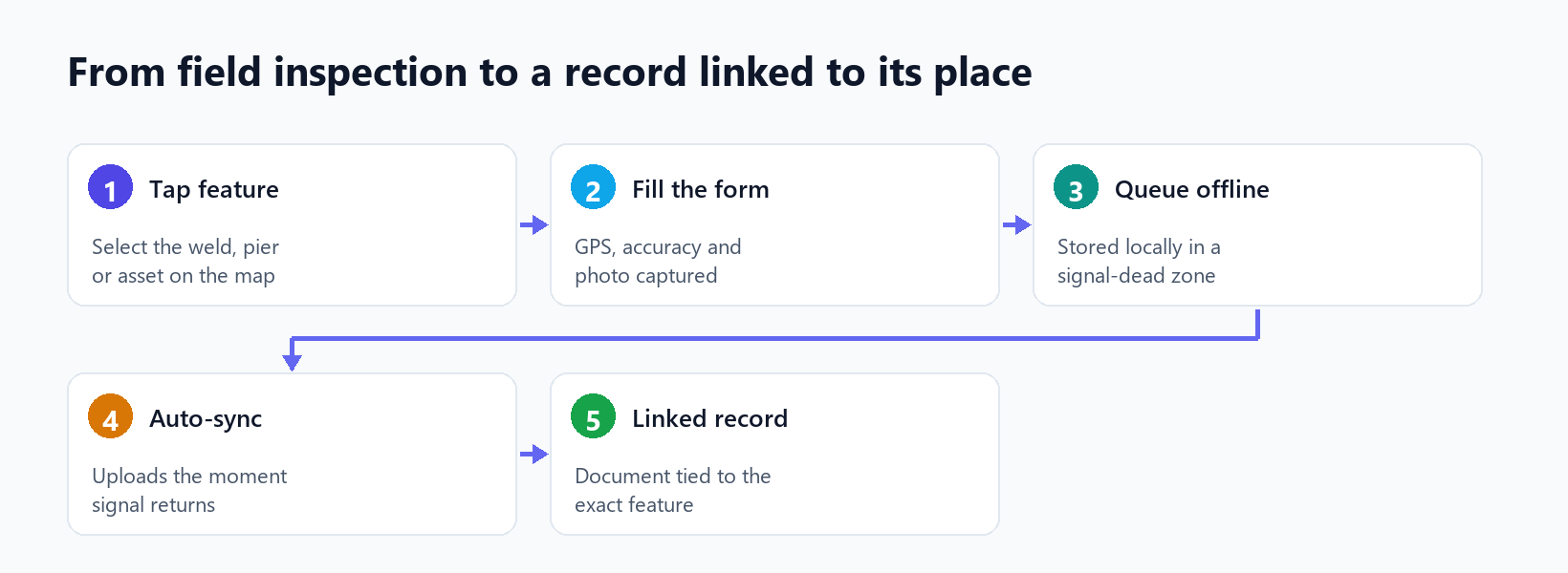
Figure 1. How a field inspection becomes a record linked to its exact location.
Here is a common example. An inspector finds damage on pier three of a bridge. Here in traditional setup, the defect report goes in one system, the repair drawing in another, the warranty in a third, and the location in a fourth. To close out that one defect, someone has to open separate programs and line them all up manually. With geoCore, the inspector logs the defect through a form linked to the pier on the map. The form opens already tied to that pier, records site data and a photo, and keeps everything in one place. The repair drawing and the warranty are linked to the same pier. Click the pier, and you see its documents. Open a document, and you see where it sits on the structure. All that back-and-forth simply goes away.
It gets even harder on linear projects, because the asset can run for hundreds of kilometers and everything ties to a point on the route. Take a pipeline inspection. Crews work along the corridor, often well past the last cell tower, checking welds, crossings, and the right-of-way. This is where geoCore's offline-first mobile app earns its keep. Before heading out, the crew downloads the map for their section. Out in the field with no signal, they tap a weld or a crossing, fill in the linked form, and capture site condition, and photos. The moment they get signal again, everything syncs on its own. No lost days, no paper notes typed up a week later, and no inspection that isn't tied to the exact spot it came from.
A corridor also creates a pile of land and permit records. Right-of-way agreements, easements, and permits for each section all cover different parts of the route, and there can be many affected landowners, often including groups that have to be formally consulted. geoCore handles this with virtual folders that build themselves from your data, so the same set of documents can be browsed by kilometer, by permit, by landowner, or by crossing type, without anyone re-filing anything. Easement agreements link to the parcels they cover. You can save a "consultation" view, an "environmental" view, and an "engineering" view as separate maps of the same corridor, so each team sees it the way that makes sense to them.
All the way through, every upload, edit, and inspection is recorded in an activity log with who did it, when, and what changed. For owners and regulators who need proof of an asset's full history, that log is ready whenever they ask, instead of being thrown together in a rush before an audit.
It all ties back simply. Article 1 talked about scattered systems, the split between documents and location, version confusion, a weak link between the field and the office, and deadlines that slip. On a civil or linear project, geoCore deals with each one by making the map the backbone and attaching documents, forms, field data, and deadlines to the features they belong to. The result is fewer programs open at once, far less lining things up by hand, and fewer decisions made on the wrong version of a file.
Written by ChaarSuu
Read on LinkedInLiving some of these problems?
We build closely with a small group of construction and infrastructure teams. If this sounds like your work, we'd like to talk.
More insights
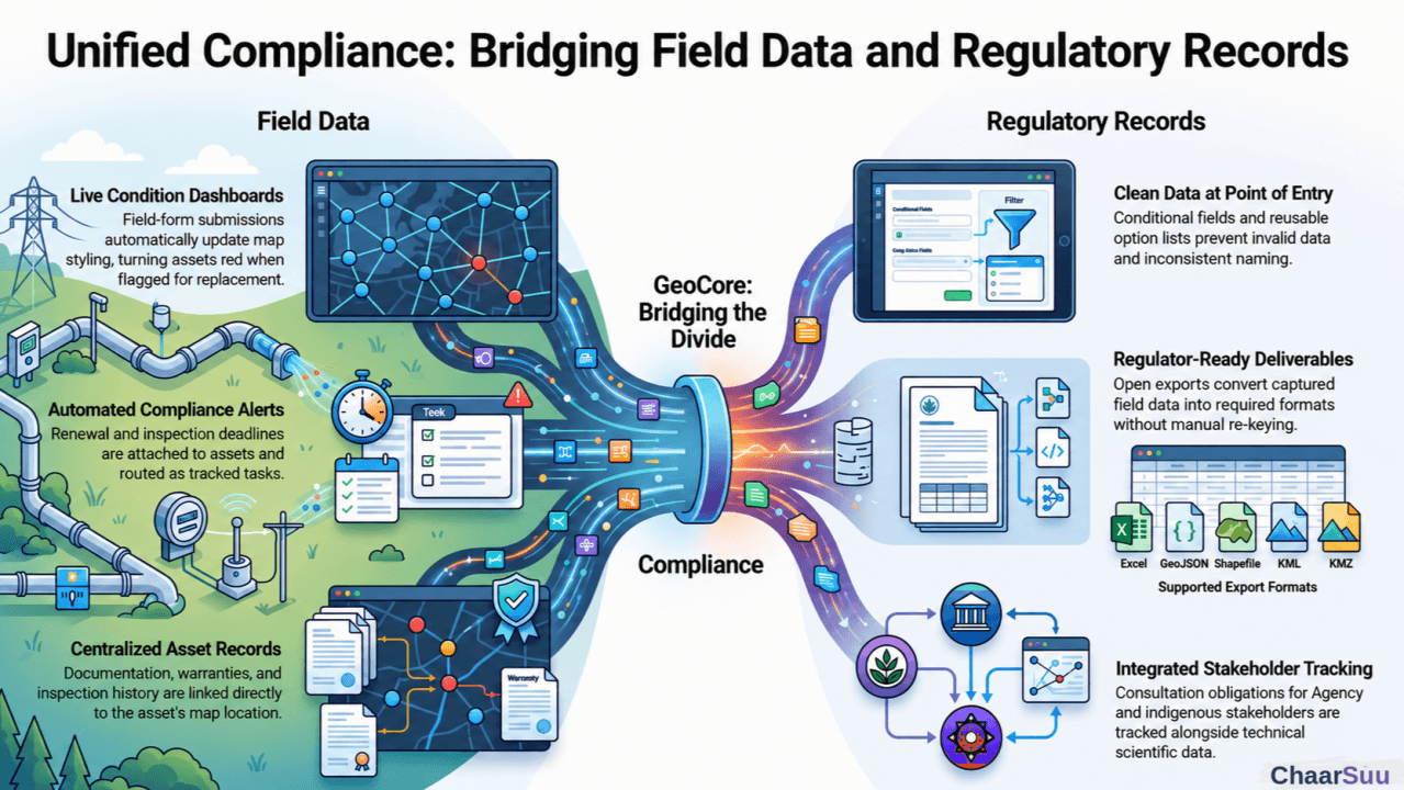
Utilities & Environmental Services in Practice
The third article in the series shows how utilities and environmental firms keep field data, documents, and deadlines tied to exact locations, so the data captured in the field is the same data used to prove compliance.
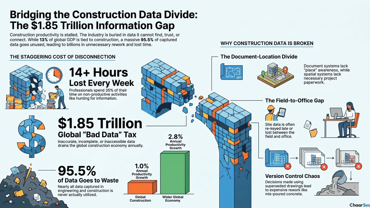
Bridging the Gap: The $1.85 Trillion Imperative for Digital Transformation in Construction
Construction is roughly 13% of global GDP and one of the least improved industries on earth. Part one looks at the fragmented-data problem behind an estimated $1.85 trillion in annual waste.