
Part 3: Use Cases
Utilities & Environmental Services in Practice
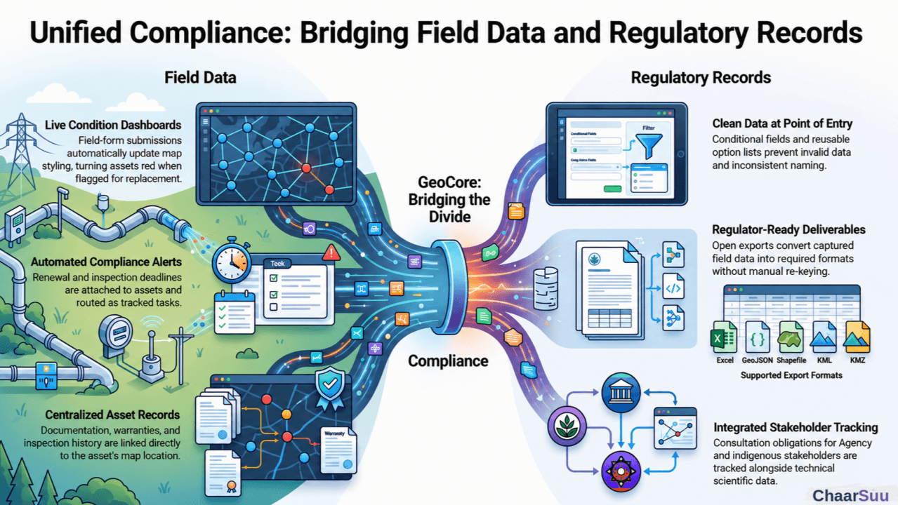
Utilities and environmental services look like very different businesses, but they share a defining trait: both depend on tying precise field data to precise locations, and both pay heavily when that link breaks. They map cleanly onto the problems set out in Article 1.
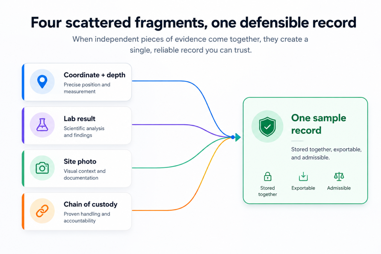
Figure 1. Disconnected fragments captured as one defensible record.
Utilities run networks of distributed assets, mains, transformers, poles, and meters, built and maintained over many years. For some utilities, one recurring failure is that asset documentation lives apart from the network map. When a transformer fails, the crew needs its installation record, its last inspection, its warranty, and its exact location, and those may be scattered across separate systems.
With geoCore, the network is modelled as layers organised the way the utility actually thinks about it, and each asset carries its linked documents. Two capabilities change daily work. First, data-entry-driven styling lets the map colour features straight from field-form submissions, so an asset flagged "needs replacement" in the field turns red on the network map automatically. The map becomes a live condition dashboard rather than a static drawing. Second, alerts attach renewal, inspection, and compliance deadlines to the asset's records, route them to named assignees, and escalate when they are ignored, so a statutory inspection becomes a tracked task rather than a date in someone's personal calendar. Crews work from the offline-first mobile app with map tiles downloaded in advance, because vaults, basements, and rural line sections are precisely where the signal is not. Saved sub-maps give operations, engineering, and vegetation management their own views of the same network.
Environmental and remediation work is intensely spatial and intensely documentary at the same time, which is exactly where the document-location divide causes the most damage. Every sample has a coordinate, a depth, a lab result, a chain-of-custody document, and a regulatory threshold. A result that cannot show exactly where it was taken, by whom, and under what conditions is not evidence; it is an invitation to challenge.
Yet, the typical workflow still runs from field notebook to spreadsheet to final report, requiring a manual transcription step at every seam, often while consulting teams turn over mid-project. When collection, storage, and reporting are spread across disparate tools, critical information goes missing, and a potentially defensible report quickly turns into a liability.
Picture a contaminated-site investigation. A field technician collects soil samples across a site. Using geoCore, each sample is captured through a structured form tied to its exact location, storing geometry, accuracy, photos, and field values as one record. Dynamic metadata schemas with cascading and conditional fields keep that data clean at the point of entry: choose a medium and only the relevant analytes appear, choose a site area and only valid sub-locations remain selectable. Bad combinations cannot be entered. Reusable option lists end the quiet poison of the same analyte being spelled five different ways across a dataset.
When the lab results come back and the report is due, geoCore's open exports turn the captured data into regulator-ready deliverables in Excel, GeoJSON, KML, KMZ, or Shapefile, with no re-keying and no lock-in. Stakeholder records sit in the same project as the technical data, with contacts classified by type, including Agency, Ministry, and Indigenous, so consultation obligations are tracked alongside the science instead of in a personal spreadsheet. And the audit trail records every upload, edit, and submission with who, when, and what changed, providing the chain of evidence for any future needs.
As mentioned in Article 1, utilities and environmental firms suffer from fragmentation, lost field data, and the difficulty of producing clean output. In these cases, geoCore's answer is to keep the record, the location, the field capture, and the obligation together, so the data captured in the field is the same data used to make decisions and prove compliance.
Written by ChaarSuu
Read on LinkedInLiving some of these problems?
We build closely with a small group of construction and infrastructure teams. If this sounds like your work, we'd like to talk.
More insights
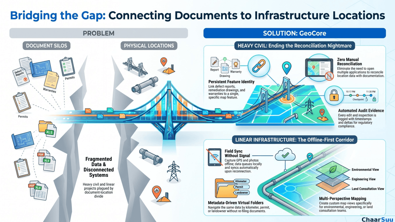
Civil Engineering & Linear Infrastructure in Practice
The second article in the series shows how the data problems from Part 1 play out on roads, bridges, pipelines, and rail, and how geoCore makes the map the backbone.
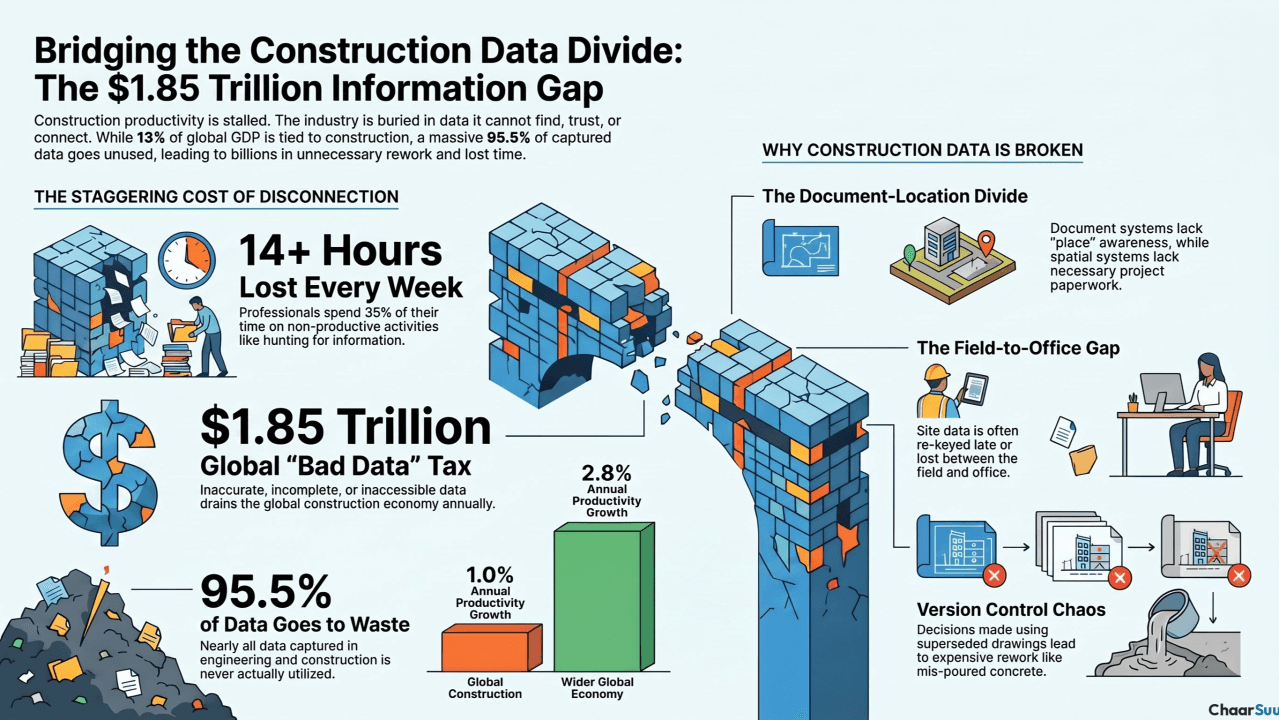
Bridging the Gap: The $1.85 Trillion Imperative for Digital Transformation in Construction
Construction is roughly 13% of global GDP and one of the least improved industries on earth. Part one looks at the fragmented-data problem behind an estimated $1.85 trillion in annual waste.